
Photogrammetry
Our drone technology allows us to capture unique angles and perspectives of your home or project. Giving the ability to create site maps, 3D images, measuring land, buildings, future pool sites.
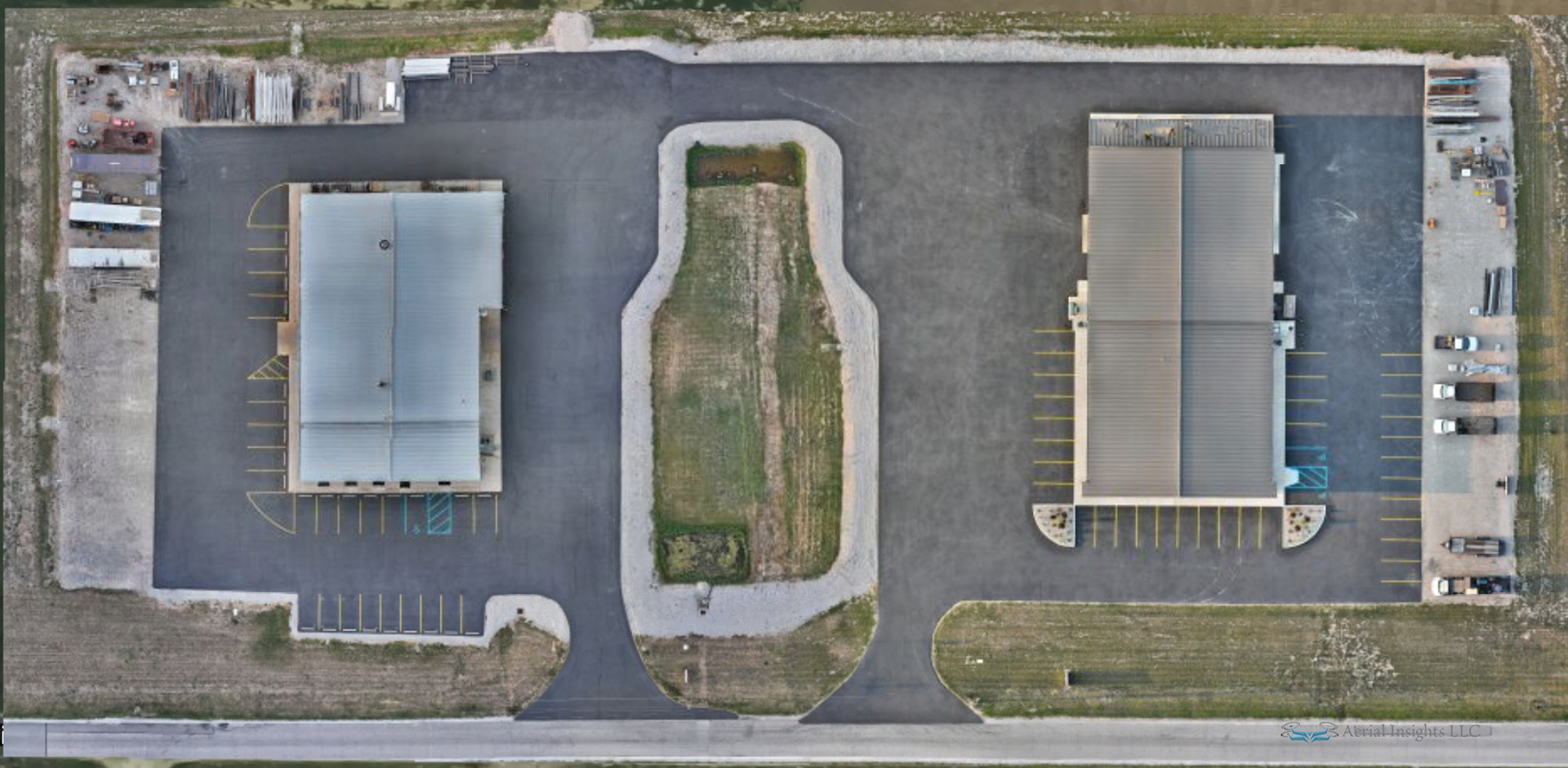
Orthomosaic
Our drone technology allows us to capture georeferenced aerial photographs to create a 2D map-like product delivered from photogrammetry by stitching together multiple, geometrically corrected aerial images to form a single, seamless image.
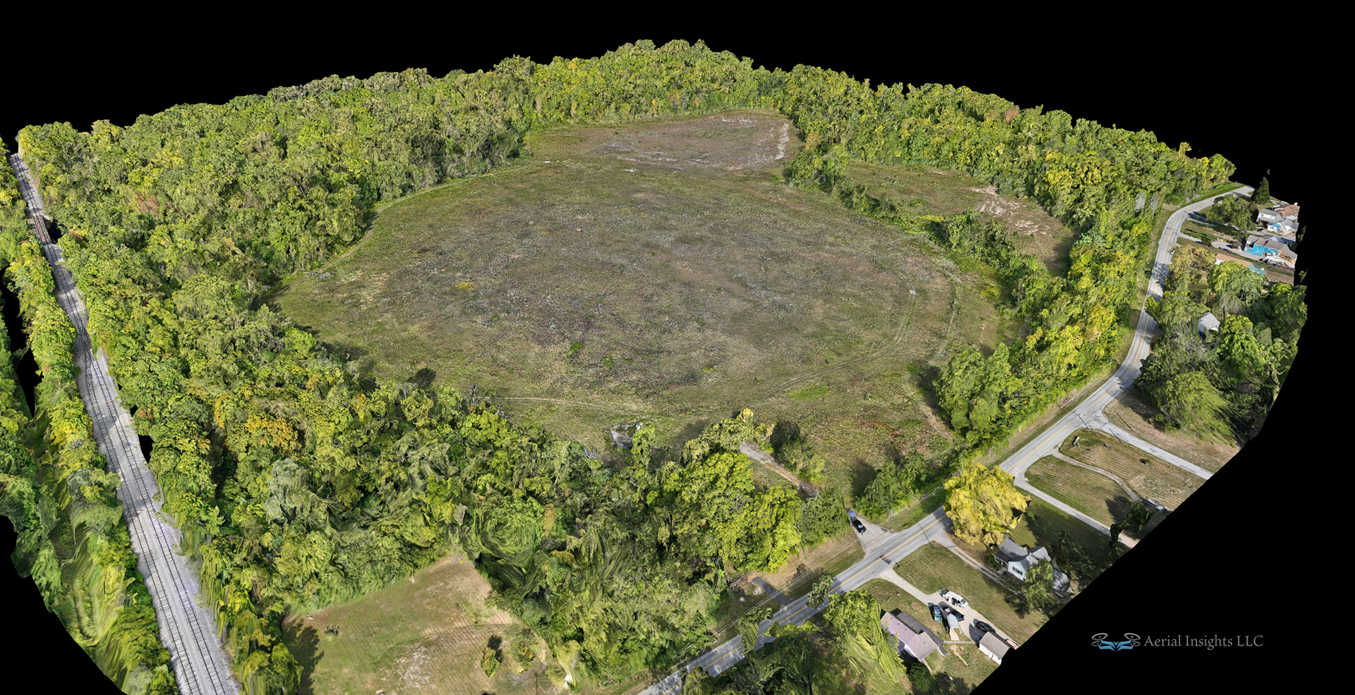
3D Mapping
Our team of experienced drone pilots can capture stunning landscape images from above, showcasing the beauty of your surroundings in a way that can't be achieved with traditional photography. From mountains to oceans, we've got you covered.
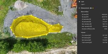
Stock Pile Measuring
Our drone technology allows us to capture unique shots of buildings and structures from above, showcasing their beauty and complexity. Whether it's a historic landmark or a modern skyscraper, we can capture stunning images that will amaze your audience.